

Every time someone looks at a map of the South Pacific and reads the name New Zealand—just like hearing the names New York, New Jersey, or New South Wales—a humorous geographic question inevitably pops into mind: if there is a New Zealand, where on Earth is “Old Zealand”? While many English speakers instinctively guess that it must be the large Danish island of Zealand (Sjælland, home to Copenhagen), the real namesake of New Zealand is actually a picturesque, wind-swept western coastal province of the Netherlands spelled Zeeland—a land of historic dikes, medieval seaports, and engineering triumphs that literally translates to “Sea-Land.”
Abel Tasman (1642) and the Dutch Cartographers
How did a Dutch province in the North Sea give its name to an island nation twelve thousand miles away in the Southern Hemisphere? During the seventeenth century—the Dutch Golden Age—ships of the Dutch East India Company (VOC) headquartered in Batavia (modern Jakarta, Indonesia) were systematically mapping the unknown southern ocean. At the time, western Australia was already called Nieuw-Holland (“New Holland”) by Dutch sailors after the main maritime province of Holland.
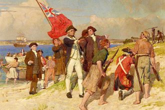
In December 1642, the Dutch explorer Abel Janszoon Tasman became the first European to sight the rugged western coastline of the South Island of New Zealand. Initially, Tasman himself named the land Staten Landt, assuming it was connected to Staten Island off the tip of South America. However, within two years (by 1645), once another Dutch voyage proved that Tasman’s discovery was not connected to South America at all, official Dutch cartographers in Amsterdam—most notably Joan Blaeu—renamed the new southern landmass to pair symmetrically with Nieuw-Holland (Australia) right next door: naming it Nova Zeelandia in Latin and Nieuw-Zeeland in Dutch, after the second great maritime province of the Dutch Republic, Zeeland! A century later, when British Captain James Cook circumnavigated and mapped the islands in 1769–1770, he politely kept the Dutch name and simply anglicized the spelling to New Zealand.
Where Is the Real Zeeland? A Province Built Below Sea Level
If you travel to the southwestern corner of the Netherlands today, right where the great Scheldt, Maas (Meuse), and Rhine rivers empty into the North Sea just north of the Belgian border (Antwerp and Bruges), you step into the real “Old Zealand”: the Dutch province of Zeeland, governed from its historic medieval capital of Middelburg and home to around 390,000 inhabitants.
No place on Earth better deserves the name Zeeland (“Sea-Land”):
- An Archipelago of Former Islands and Peninsulas: Composed of a network of coastal islands and peninsulas (such as Walcheren, Zuid-Beveland, Noord-Beveland, Schouwen-Duiveland, and Tholen) plus a strip of mainland bordering Belgium (Zeeuws-Vlaanderen), huge swathes of Zeeland sit several meters below mean sea level, reclaimed from the ocean floor over centuries by miles of earthen dikes and polders!
- The Coat of Arms (“I Struggle and Emerge”): The official heraldic flag and coat of arms of Zeeland depicts a red lion rising waist-deep out of blue-and-white ocean waves, accompanied by the defiant Latin motto: “Luctor et Emergo” (“I Struggle and I Emerge”)—celebrating both the province’s war for independence against Spain and its thousand-year battle to keep the North Sea from swallowing its towns.
The 1953 Flood and the Engineering Wonder of the Delta Works
The defining chapter of modern Zeeland’s history occurred on the freezing night of January thirty-first to February first, 1953, when a catastrophic North Sea storm surge combined with a high spring tide smashed breaches through hundreds of Zeeland’s sea dikes, flooding vast areas of the province beneath icy seawater and claiming the lives of 1,836 people in the Netherlands.
Vowing that the sea would never drown Zeeland again, the Dutch government spent the next forty years constructing what the American Society of Civil Engineers declared one of the Seven Wonders of the Modern World: the Delta Works (Deltawerken)—anchored in Zeeland by the colossal five-mile-long Oosterscheldekering storm-surge barrier, whose sixty-two giant steel sluice gates stay open on calm days so saltwater tides and marine life can flow freely into the bay, and slam shut automatically whenever a dangerous North Sea storm approaches. Today, with its white-sand beaches, world-famous Zeeland blue mussels and oysters, and picturesque harbors like Veere and Zierikzee, “Old” Zeeland remains one of the most fascinating maritime landscapes in Europe.